
Greetings;
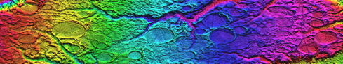
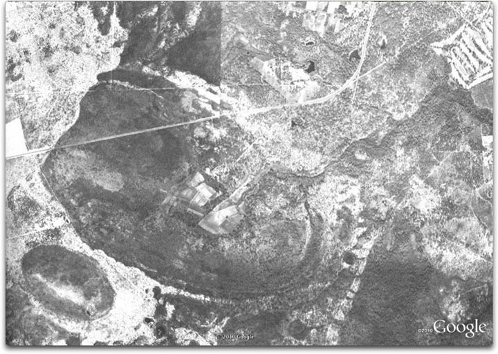
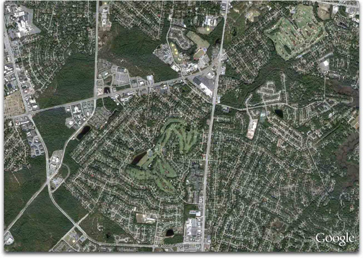
Here is an interesting mash-up of historical imagery by way of 3 images: an old aerial photograph, a current Google Earth view, and high-resolution hsv-shaded Digital Elevation Map.
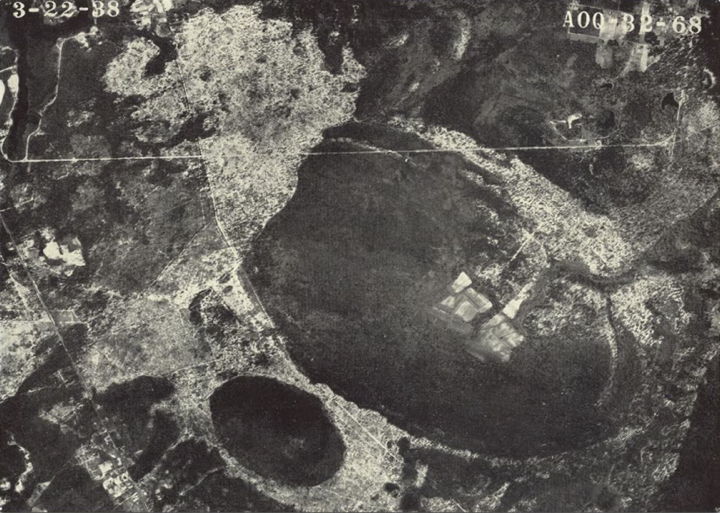
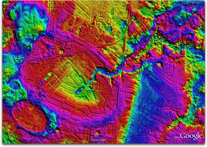
When Harry Savage assembled his expansive review of Carolina bay research for his 1982 Book The Mysterious Carolina Bays, he included a significant number of black-and-white photographs of bays. Most of these are sadly unattributed, but show what those bays looked like before urbanization overtook them. In this particular instance, Blythe Bay was easily apparent in the early imagery, but entirely obscured in the present-day satellite views, as Wilmington, NC ,expanded across it. Now that LiDAR derived DEM mappings are available, the bay again is visible in its glory.
In these three images, we see the progression. The kmz file linked HERE contains the elements to view this in Google Earth.
Blythe bay was investigated extensively in the early 1940's. As told by Savage:
It would seem that the ocean's encroachment would have had to occur either at the last high stand over 100,000 years ago, or at the onset of the Holocene, when sea levels briefly reached above today's.In 1943, B. W Wells of North Carolina State College reported to the Elisha Mitchell Scientific Society the preliminary conclusions of the study he had made of Blythe Bay in the southeastern suburban area of Wilmington, North Carolina. His work would later become part of one of the most intriguing research studies in Carolina bay literature. He told the society that in Blythe Bay the interior of which is about thirty-five feet above mean sea level, he had found five or six feet of typical bay peat lying beneath seven feet of plastic clay and fine sedimentation which could only have been deposited there through an invasion by the sea during a temporary re-elevation of the ocean that had occurred long after the bay had come into existence. A delta-like structure within a gap in the bay’s rim reinforced Wells’ conclusion. Wells’ studies soon led him to the crux of the bay riddle-the origin of the phenomenon. During the ensuing decade Wells, with colleague Steve G. Boyce, sought corroborating evidence in other bays in the Wilmington area of what he had deduced from the sediments of Blythe Bay.
I have located the original paper by Wells, hosted on the UNC library website: Linked HERE . It includes a slightly different B&W photo, dated 3/22/38.
Wells was quite emphatic that he read a catastrophic genesis for the bays. The referenced paper discusses at length how he felt the majority of bays never hosted bodies of water, but simply grew peat deposits many feet in depth on their moist bottoms. Note that peat bogs do not form in open water. His interpretation of the bay lakes which are in existence today is because that - for a very few - they lie low between major rivers and are controlled by water table levels, while many of the bays with water exist because peat within bays had been burned out in the dry periods of the middle Holocene, based on significant findings of charcoal. His assessment of the peat at the lowest levels is "over 20,000" years old, and might be 40,000 to 100,000 years old.
Current consensus amongst scientists says that the bays' rims - and their ovoid planforms - were entirely the result of wave action by standing water. Those bays must be large enough to offer significant reaches to enable wave formation.
Here is Well's 1938 photo, as sourced from the UNC Library: