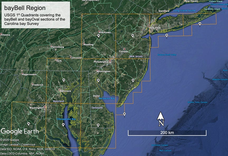

The Bay-Bells of Maryland, Delaware and New Jersey
Do the Carolina bays extend across the North Carolina border into Virginia, Maryland, Delaware and New Jersey? We believe so, and base our interpretation on LiDAR imagery of various basins across the coastal plains of those states. We have no LiDAR for Virginia, the NED data available, and the imagery presented in Google Earth (both current and historical) demonstrate a continuation of the classic oval shape across the NC border into VA. When viewed with the same facilities, we see the Eastern Shore of Virginia dotted with a nearly symmetrical oval shape, vs the slightly skewed (s/w side flattened) in North Carolina.
Once into Maryland (moving northward along the coast) we see a new planform slowly evolve. We have nicknamed this the “bellBay_Prototype”, and it continues to persist northward, across New Jersey, and right up to the Late Wisconsin glacial moraine and outwash tills. A representation of the overlay used in our Survey is shown below rotated to a generic orientation:
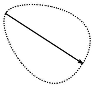
bayBell_Prototype Overlay Planform Design
Until the advent of LiDAR, the odd shape these planforms present in aerial imagery did little to help identify their lineage. Indeed, when these were identified as Carolina bays by others, they have suggested they have an orientation 90 degrees clockwise from our interpretation. This is especially true as the bays become squatter and more oval. In New Jersey, these landforms are considered to be thermokarst features formed during thaw of permafrost after the last glacial maximum 20,000 years ago. Our working hypothesis suggests that the bays - as “burst bubbles” within a superheated sandy ejecta blanket - will generate planforms based on the skewing generated by the ejecta’s velocity vector and that of the earth at the landing site. This changes based as a function of the cosine of the latitudes of impact site and the ejecta's eventual emplacement location.
The area we consider here is often covered with extensive sheets of sand dunes, likely created during dry periods over the millennia. We see in some areas where these dunes and our bay-Bells interact, but as in the Carolinas, the two planforms are quite distinct and very easy to discriminate between. See our Dunes & Bays Topic.
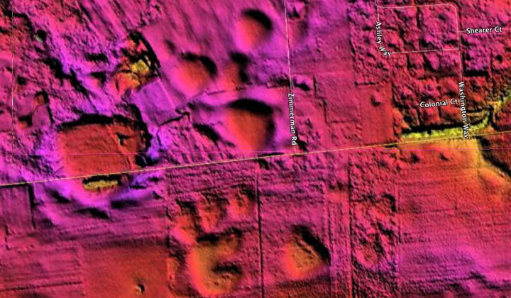
As we progress north from southern Maryland, the bays become less oval and more pointed on the NW end, and even squatter and - most importantly - flatter on the southeastern side. Each image’s caption is hyperlinked to the Google Earth planform overlay we assigned to the landform. This will open in GE, but be aware that the LiDAR needs to be separately loaded from the Ocant Map, or by loading the appropriate full 100K Quadrant meta data KMZ files listed at the bottom of this page.
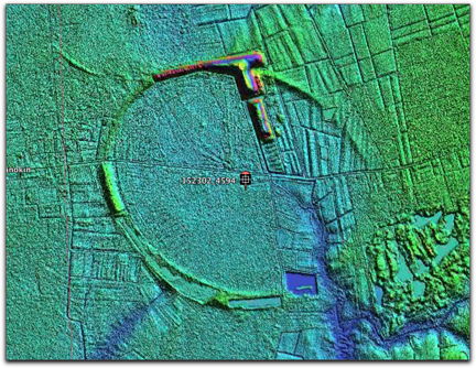
152302_4594
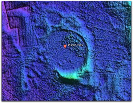
153302_7685
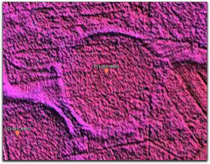
153303_9003
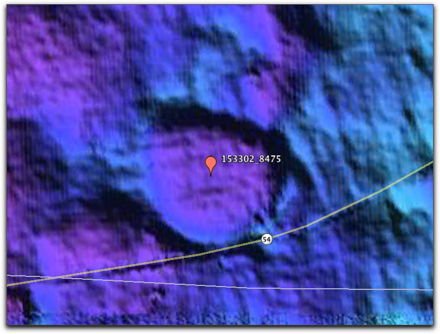
153302_8475
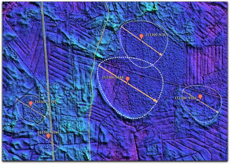
153300_9488
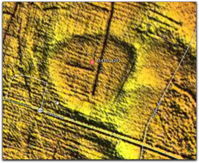
154303_8233
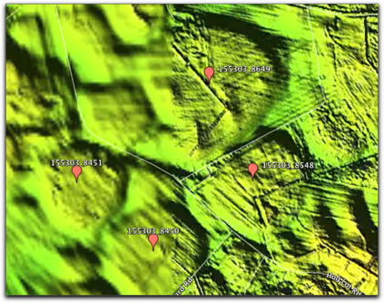
155303_8649
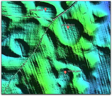
157303_2177
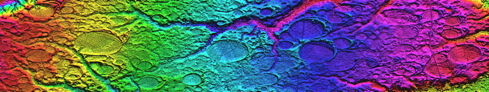
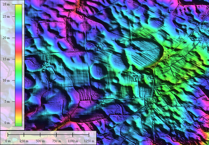
Here is an area in central Maryland presented as an Elevation map:
Bay 156303_7384
The examples continue into the state of New Jersey, the first here is immediately east of the Delaware Memorial Bridge...
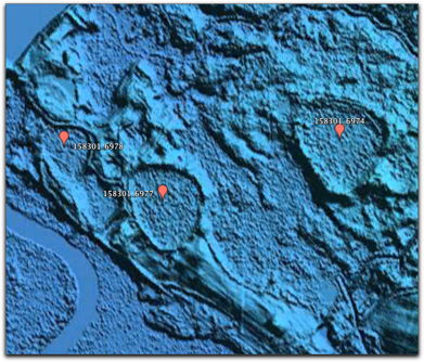
158301_6977
We noted another possible instance of an "ancestral drainage channel" smothered by the ejecta blanket. In the attached photo, there is a small exposure of the old drainage in the basin on the left, while the drainage suddenly emerges from the layer on the far right.
We interpret the "springs" as upwellings from these still-active buried channels.
Bay 159298_3881 & Tabernacle, NJ Buried Drainage Channel
Finally, we reach up into the Princeton, New Jersey area:
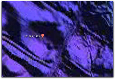
161298_1533
Our most Northerly bay complex is in Mammoth County, just north of the US Navy’s Weapons Station Earl.
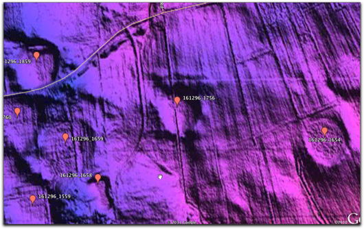
161296_1859
The area covered by the above imagery extends across multiple 1º USGS Quadrants. The Carolina bay Survey's "bayBell Region" can be accessed with this KMZ file
http://cintos.org/ge/survey/bayBell-Region.kmz