
Bays in Midlothain, VA
Perhaps the most enigmatic, oriented elliptical Carolina bays identified to date on the East coast exists in the town of Midlothian, VA. This is because the sandy rims of the basins lie on top of a gravel substrate. As such, a rational depositional process must be identified to account for all this pure quartz sand across the area. Gravel is located in the floor of the basins, but the basins are proposed to be simple voids in the sandy ejecta layer, allowing the antecedent surface to remain prominent.
Excerpt from: GEOLOGY OF THE UPLAND GRAVELS NEAR MIDLOTHIAN, VIRGINIA
By Bruce K. Goodwin
http://abob.libs.uga.edu/bobk/cbayvirg.html
The flat, undissected upland surface of the Midlothian gravels is marked by numerous elliptical to sub-circular depressions or basins. These basins were first reported by Johnson and Goodwin (1967). Over twenty such basins have been recognized in this area and nineteen are shown on Figures 2 and A. The basins have formed on the Midlothian gravels and the basin sediments are immediately underlain by course gravels. The elevation of the basin floors is between 345 to 360 feet above sea level and a low ridge or rim surrounds the basins (Fig. 4). This rim from five to 15 feet high, is most commonly best developed on the south and east sides of the basins. The basins range in size frown a few hundred feet to more than three quarters of a mile and where elliptical, their major axis trends from N 60° W to 80° W. The undrained basins contain organic-rich, fine-grained sediments and support a hygrophilous flora. A few of the basins have been breached by streams and are being drained. Because of the similarities between these depressions and the well-studied elliptical depressions known as Carolina Bays on the central and southern Atlantic Coastal Plain of North America, the authors have adopted the same name for the shallow basins on the Midlothian gravels.
A section from the interior through the rim of one of the Carolina Bays in this area is described in Stop No. 7 of the road log of this guidebook end only an outline is presented here. In general the section shows that the rim is underlain dominantly by sand containing some pebbles but only very minor amounts of clay. Rarely cobbles or pebbles occur within the sand. A pronounced decrease in sand occurs from the rim toward the bay's interior and massive, brownish-gray, silty clay with a few scattered quartz pebbles becomes the dominant sediment. This clay is in direct contact with the underlying gravels. The lateral transition from sand to clay is gradational but occurs within a distance of less than 200 feet from the rim.

Here is a link to a kmz file for use in Google Earth browsing:
Goodwin's description of the rim sand is consistent with the our general ejecta premise: the blanket of hot ejecta, as a "coat of paint" is energetically laid down across the terrain, and occasionally a bubble of steam forms. The result is a bay with a sandy dike-like perimeter, but virtually no ejecta across the floor of the structure. This process also makes dating the structure problematic, as the typical approach is to core the center of the bay. Since the floor has no recognizable ejecta horizon, the core, and it's associated dating, can go back to 50,000 or 100,000 kya as earlier strata is encountered.
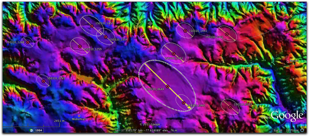
The following graphic is a Google Earth image, using an overlay crated in Global Mapper image using USGS NED 1-3 arc sec DEM data.
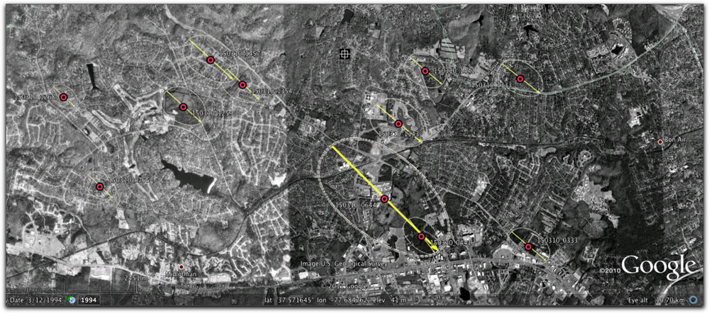
... and the same area in Google Earth Imagery. Both show our proposed bay locations.
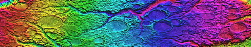
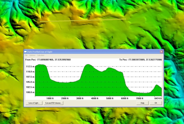
Again created using Global Mapper application, this next graphic shows the elevation profile across a sample of bays:
I visited the area in March of 2011. My superficial survey suggests that while the "bays" might indeed be resting "on" gravel, but they are most certainly composed of pure sand. I took some samples along Old Bon Air Road, along the northern rim of my bay #150310_0333. I managed to find a new house being built on "Bon Air Crest", which is along the rim, and found a large uprooted tree in the rear lot, with the soil from 2 feet down was exposed for my sampling.
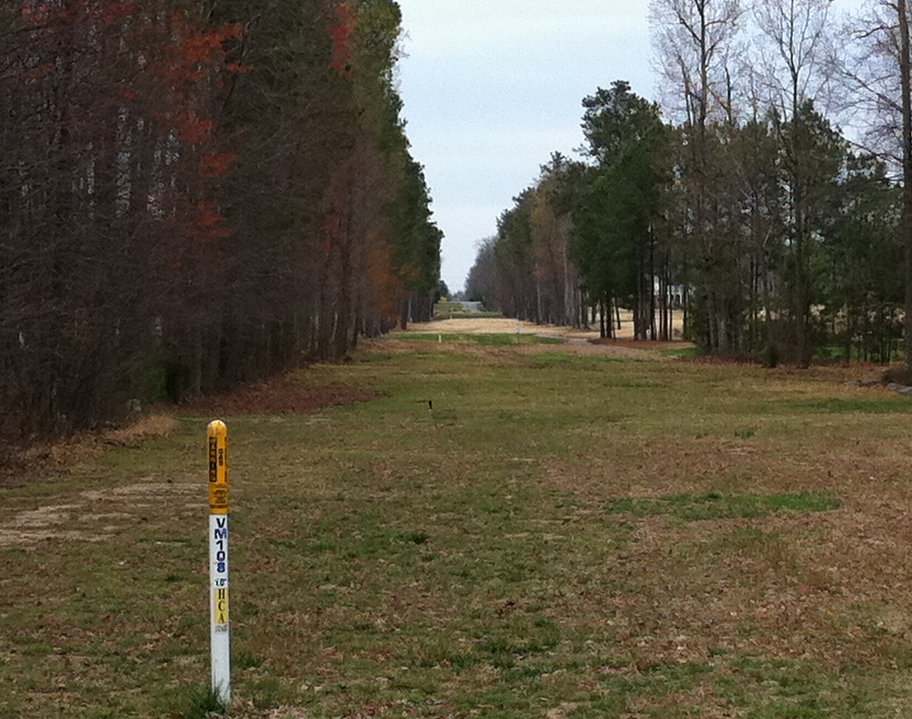
My visit to the "golf course" bay (150310_1259) was brief but helpful. I did not get any samples, as just about every square foot I saw had been developed on. One neat aspect is that a section of railroad bed was abandoned across the bay, and the swath is still there and wide open (a buried pipeline is present). This allows a great view down in, across, and up the far side. I say "up" as a relative term, as the rim is shallow. In the photo, taken SSE, you can see the paved part of Kings Lynn Road drop down into the bay in the distance. I am just inside the rim here. It is ~ 850m horizontally to the foot of the paved road area, and ~1050m to the top of the rim.