
The Bays of Virginia’s Eastern Shore
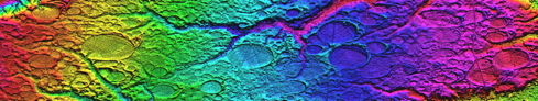
We have recently obtained LiDAR for Virginia, and are now able to demonstrate a continuation of the classic ellipsoidal shape across the NC border into VA. As we progress north from North Carolina, the bays become more pure oval, almost round (makes a better burst bubble...). To capture the planforms with good fidelity, we are using a slightly altered “bayShore” overlay for use in Google Earth, shown below:
bayShore Overlay Planform Design
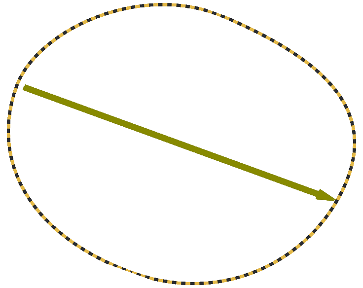
The first set of data covers the Eastern Shore - the peninsula which separates the Chesapeake Bay from the Atlantic Ocean. Here is a view of that area. A huge (100MB) .TIFF file is available HERE.

Eastern Shore of Virginia
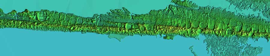
Until the advent of LiDAR, the odd shape these planforms present in aerial imagery did little to help identify their quantity. Prior to the LiDAR availability, I had inventoried less than 100 bays down the Eastern Shore. The survey now contains 700 (see last map). Here are a few images created in Global Mapper. Each caption is linked to a 32 MB TIFF version of the image. The sequence is from the North to the South:

Eastern Shore #1

Eastern Shore #2

Eastern Shore #3

Eastern Shore #4

Eastern Shore #5

Eastern Shore #6

Eastern Shore #7
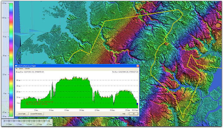
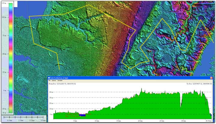
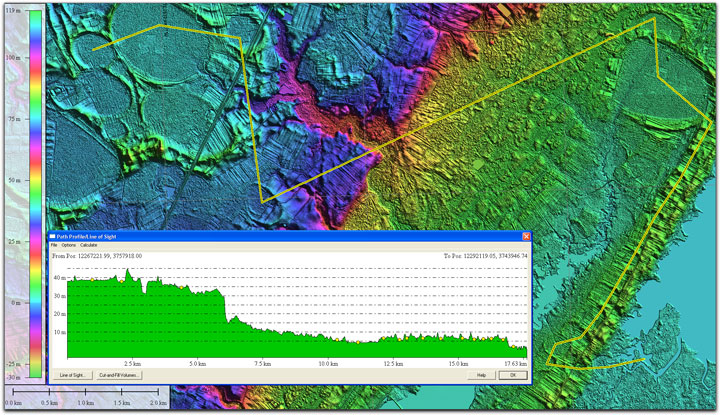
While the collection of bays found down the high spine (~30-40 m) of the peninsula has been well know, we have identified a significant number of these landforms present on much lower elevations, both on the Chesapeake side (~5- 20 m) as well as on the Atlantic side (~5 - 20 m). The following graphic demonstrates the various elevations seen, using Global mapper’s elevation profile tool. The legends are linked to higher resolution versions.

Eastern Shore Elevation Profile #1
Eastern Shore Elevation Profile #2
Eastern Shore Elevation Profile #3
Eastern Shore Elevation Profile #4
I would have expected those to the East, on lower elevations, would have been destroyed by surf at some point in the past. Perhaps this area was kept above the surf since their creation by the glacialisostaic fore bulge from the Wisconsin ice sheet. The shore edge in the graphic above does exhibit a scalloped effect, which are possibly remnants of a set of shore-truncated bays at sea level.
Eastern Shore Barrier Island Bays (rotated)
The area covered by the above imagery extends across two 100K Quadrants. The KMZ files for these are linked to their USGS names, below, which should open in Google Earth to allow visualization on the virtual globe:
Chincoteague_100K
Cherlton_100K
The map below is generated from our survey’s Google Fusion Table, and contains over 700 bays on the Eastern Shore (of >21,000 total). Each placemark has an associated popup info window with the bay’s metrics displayed, along with a link to the planform overlay for viewing in the Google Earth application on your computer. If this embedded maps widget does not function, please use this LINK to open a new browser window and load directly from Google’s site. Choosing “Satellite” in the Goggle window here will present satellite imagery, but few of the Eastern Shore bays show in that view; LiDAR is required.