
SOAR LiDAR HRTMs
Carolina bays.
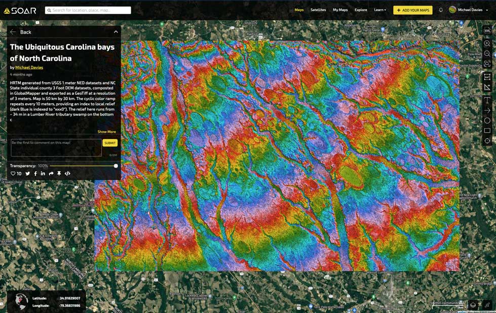
This Digital Elevation Map covers ~ 812 km2centered on Rex, NC (Robeson County), and was generated in the Global Mapper GIS program using LiDAR data from the USGS. The colors shown are an indication of topographic elevation, from 38 m AMSL in the lower right, to 73 m in upper left. Vertical resolutions of centimeters allow for visualization of the form and extent of the bays’ otherwise imperceptible rims. Rockfish Creek flows along the northern edge. CSX’s Atlantic Coast Line rail bisects the area diagonally along a strikingly straight right-of-way; Interstate 95 winds N-S on the right.
To view the entire depth of this image's resolution. Use the SOAR facility.